Announcing the Release of Our Flagship Carbon MRV Whitepaper
Michael Wu
Mar 27, 2024
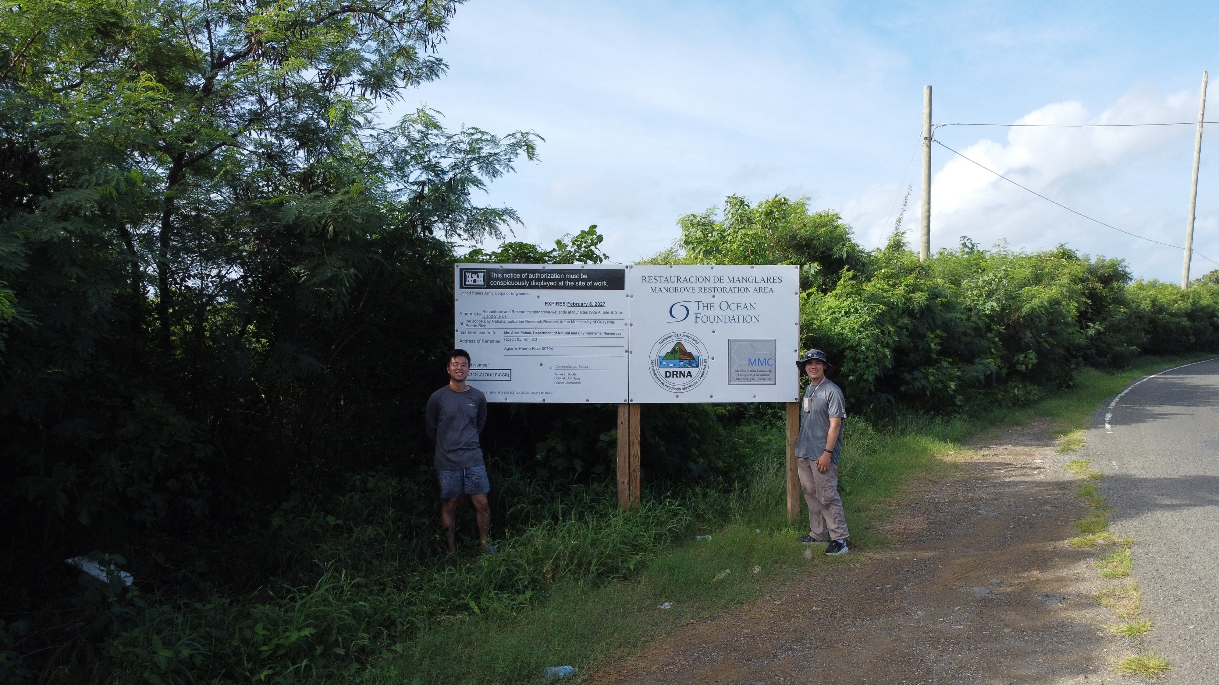
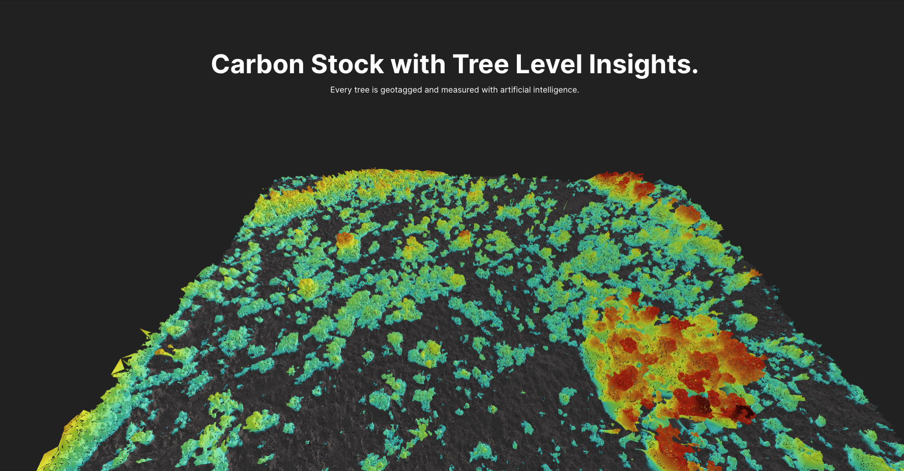
In this flagship whitepaper, we introduce an accurate and scalable reforestation MRV method based on Neural Radiance Fields (NeRFs) that reaches 97% accuracy compared to LiDAR over 170 acres of a mangrove restoration project in Jobos Bay, Puerto Rico.
Abstract
Carbon measurement, reporting and verification (MRV) for reforestation projects is essential for the accurate creation and credibility of carbon credits. However, existing MRV solutions face significant challenges. Hand measurement is labor-intensive, time-consuming, and difficult to trust, satellite imagery is not accurate enough, and airborne LiDAR remains prohibitively expensive at scale. In this work, we introduce an accurate and scalable reforestation MRV method based on Neural Radiance Fields (NeRFs) and a carbon segmentation model that is cost competitive with hand measurement. To evaluate our model performance, we quantify the above-ground carbon stock of the Ocean Foundation's flagship 700-acre mangrove restoration project in the Jobos Bay National Estuarine Research Reserve. We reach 97\% accuracy of carbon stock and 98\% accuracy in number of trees detected compared with state-of-the-art airborne LiDAR models. We hope that our project can support the advancement of accurate and scalable forestry modeling with commercial drones and computer vision, facilitating a new gold standard for reforestation MRV.
Introduction
Forestry monitoring, reporting, and verification systems today are dominated by one piece of technology: the tape measure. Dating back to the 1930s and 1940s, the tape measure and allometric equations began to gain scientific popularity for estimating the relationship between tree dimensions like trunk diameter and biomass [1-3]. One hundred years later, the tape measure remains the dominant form of data collection technology for forestry.
Nature is clearly one of the most important tools we have to fight climate change, [4] but shoddy legacy tools for quantifying nature like the tape measure have held back capital investments and prevented reforestation from playing a larger role in regulating our climate. Today, trust in nature based data around carbon is at an all-time low. Because the collection process happens on pen and paper without third party oversight, a lack of transparency has plagued industries like the carbon markets, which rely on the tape measure as its primary form of authentication. Manual measurement over an entire forest’s scale through unforgiving terrain is unrealistic, expensive, and time consuming, so it is standard practice to sample less than 0.1% of a forest and extrapolate over thousands of acres.
Unscrupulous actors have taken advantage of these flaws in carbon markets, inflating growth rates, deforestation levels, and conservation rates to their own economic advantage. Multiple scandals have rocked the nature based carbon sector in the past year, toppling even the largest and formerly most reputable projects [5,6].
Alternatives to the tape measure such as satellite based quantification systems, mobile phone application scanners, and airborne LiDAR systems do exist but for a variety of reasons, have failed to gain mass adoption in forestry projects. These reasons boil down to a cost - accuracy - transparency conundrum. The most trustworthy and high accuracy tools have historically been the most expensive and less expensive tools like hand measurement or satellite tracking tend to be less accurate and less transparent. In particular, satellite images have limited spatial resolution in remote areas, which affect their ability to capture granular forest features such as size and height [7]. Cloud cover and other weather-related factors also impact the availability of clear satellite images, affecting the continuity of monitoring efforts [8]. While airborne LiDAR offers a relatively more accurate biomass estimation by three-dimensionally modeling vegetation's vertical structure in detail, the higher costs of equipment and logistics, as well as heavy data processing requirements, constrain the ability to deploy LiDAR at forest scale in a timely manner [9]. In short, these reasons boil down to a cost - accuracy - transparency conundrum.
Meanwhile, good actors in the carbon space suffer. Even before the scandals, good actors were forced to underestimate the carbon stocks of their forests due to the high standard error rates associated with sampling small percentages of their land. Now, with carbon prices depressed, they have been forced by market conditions to seek out additional, more expensive layers of verification and certification.
No longer. Coolant presents an inexpensive and scalable MRV system that relies only on the camera footage from commercially available, inexpensive hardware like DJI Mini drones. Applying the same advancements in artificial intelligence and computer vision that enable Teslas to drive themselves autonomously on the highway with just cameras, Coolant does 3D modeling, tree detection, and carbon stock evaluation on a forest scale.